May 2021 – May 2021 · NUST
Coconut Palm Tree Detection & Vegetation Health Assessment
Deep LearningArcGIS ProRemote SensingGIS
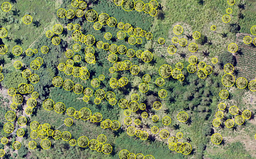
Implemented an end-to-end geospatial deep learning workflow to automatically detect coconut palm trees and assess vegetation health using high-resolution aerial imagery.
The project involved preparing training datasets, training an object detection model, and applying vegetation analysis techniques to evaluate tree conditions.
Demonstrates the application of artificial intelligence and geospatial technologies for automated vegetation monitoring, precision agriculture, and sustainable land management.
Highlights
- Prepared image training samples using ArcGIS Pro Deep Learning tools and aerial plantation imagery.
- Created image chips and training datasets for object detection model development.
- Trained and applied a Single Shot Detector (SSD) deep learning model to identify coconut palm trees from aerial imagery.
- Refined predictions using Non-Maximum Suppression to remove duplicate detections.
- Calculated the Visible Atmospherically Resistant Index (VARI) to estimate vegetation health from RGB imagery.
- Applied spatial analysis techniques including feature extraction, buffering, and zonal statistics to associate vegetation health indicators with individual detected trees.